Auckland Council has introduced important changes to the way flood hazards are managed across the region. Through Plan Change 120 (PC120) – Housing Intensification and Resilience, the Natural Hazards and Flooding (E36) chapter of the Auckland Unitary Plan has been rewritten. The revised provisions, which are now operative, move away from a purely “hazard presence” approach and adopt a risk-based framework that recognises the different levels of exposure, vulnerability and consequence for people, property and infrastructure.
A Shift from Hazard to Risk
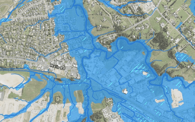
Previously, development controls focused mainly on whether a site lay within a mapped floodplain or overland flow path. The new approach looks beyond the extent of flooding to consider the likelihood, depth, velocity and impact of flooding, and how each activity interacts with that risk. This aligns with national policy direction and recognises that the presence of floodwaters does not always mean the same level of danger. Under E36, flood risk is determined by combining the characteristics of the hazard with the sensitivity of the activity. This approach enables more targeted management, ensuring highly vulnerable uses are protected while still allowing appropriately designed development in lower-risk areas.
Flood Hazard and Risk Categories
Flood hazard areas include all floodplains, flood prone areas and overland flow paths. However the plan now distinguishes four flood hazard classifications for all flood hazards. Very high, high, medium, and low, as defined in Chapter J of the Auckland Unitary Plan.
Activities are also grouped according to how sensitive they are to flooding:
Activities sensitive to natural hazards (such as residential dwellings, maraes, hospitals and care facilities),
Activities potentially sensitive to natural hazards (for example retail, offices, schools and community facilities), and
Activities less sensitive to natural hazards (such as open space, carparks, public amenities and most rural activities).
By cross-referencing activity sensitivity with the hazard classification, the plan identifies three corresponding risk outcomes: significant, potentially tolerable, and acceptable. Development that presents significant risk is generally to be avoided, while activities that fall into the potentially tolerable range must demonstrate that risk can be reduced to or maintained at an acceptable level through design and mitigation measures.
Risk Assessment and Design Response
Development within flood hazard areas must demonstrate that the level of flood risk is understood and appropriately managed.
The scale of assessment depends on the activity type and the severity of the hazard. Where an activity occurs within a potentially tolerable flood risk area, applicants must provide sufficient information to show how flood frequency, depth, and the potential consequences for people and property have been addressed, including the effects of climate change.
The revised policies in E36 relating to PC120 emphasise avoiding significant risk, and where development proceeds, mitigating risk through design that is resilient to flood hazards and climate change. Council promotes the use of nature-based or non-structural measures—such as vegetated buffers, detention or storage areas, and restored overland flow paths—before resorting to hard protection structures.
Urban versus Non-Urban Context
The plan now clearly distinguishes between existing urbanised areas and non-urban areas. In established urban environments, redevelopment may proceed where risk is tolerable and can be reduced through mitigation. In contrast, new development in non-urban areas, typically land that has not yet been urbanised or serviced—is expected to avoid locations where risk is significant. This ensures that growth occurs in places where infrastructure and resilience measures can manage flood impacts effectively.
Adapting Existing Development
The provisions also recognise that existing buildings and infrastructure cannot always relocate. The plan therefore supports adaptation over time, for example by improving resilience, reducing activity intensity, or relocating vulnerable uses to safer parts of a site. These measures are designed to progressively bring existing development to a tolerable or acceptable level of risk.
Looking Ahead
Climate change is central to the new framework. All risk assessments must consider long-term effects such as rising rainfall intensity and more frequent extreme events. The overarching goal is to ensure that Auckland’s future development pattern is resilient, adaptive and safe. For landowners and developers, this means engaging flood-risk specialists early in the design process and considering mitigation as an integral part of site planning. The revised section of PC120, E36 marks a significant evolution in how Auckland manages natural hazards, moving from simple mapping toward a deeper understanding of risk, resilience and long-term sustainability.
How CLC Can Help
At CLC Consulting Group, we help clients navigate these new flood management requirements with confidence. Our civil and environmental engineers use advanced 2D hydraulic modelling software (TUFLOW) to accurately map flood hazards, assess overland flow paths, and quantify flood depths and velocities. This detailed analysis allows us to prepare robust Flood Risk Assessments and Flood Management Plans that align with Auckland Council’s updated risk-based framework under E36.
We work closely with planners, architects and developers to integrate mitigation measures into site design ensuring that proposed developments are both compliant and resilient. Whether you are redeveloping in an existing urban area or planning new infrastructure in a growth location, CLC’s modelling expertise and local knowledge can help you achieve practical, risk-aware design outcomes and streamline the consent process. If you’re planning a development and want to understand how this new approach might affect your development, contact our team today to discuss your options.